
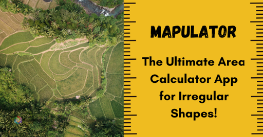
Mapulator is the best area calculator tool for measuring any kinds of land!
Have you ever tried to calculate the area of your property only to find that it’s not as simple as measuring the length and width of a rectangular plot? Measuring the distance between two points on a flat surface is easy as pie. But when it comes to measuring irregular shapes of the land, it’s a whole different ball game. It’s like trying to navigate a labyrinth without a map.
The unpredictability and complexity of these shapes make it an uphill task to get accurate measurements. Therefore measuring these shapes requires a keen eye, a lot of patience and the right area calculator tool. And when you have the right area calculator for irregular shapes, getting accurate measurements becomes easier and more efficient.
What is Land Measurement?
Land measurement is the process of determining the size, shape and boundaries of a piece of land. It is an essential aspect of land ownership and property management.
Properties that require land measurement include:
- Agricultural land for crop cultivation
- Residential properties for building and construction
- Industrial properties for factories and warehouses
- Commercial properties for retail and office spaces
- Forest land for conservation and management
Land does not always have regular shapes. In fact, many plots of land have irregular shapes due to natural features such as rivers, hills, and valleys or man-made features such as roads and buildings.
Challenges in Measuring Irregular Shapes of Land
Measuring irregular shapes of lands presents a significant challenge for landowners, surveyors, civil engineers, real estate agents and property developers who frequently need to determine the land area. The complexity lies in accurately calculating the dimensions and boundaries of such plots, which demands a great deal of precision and attention to detail. Here are a few challenges:
-
Time-consuming: The traditional measuring methods for irregular plots can be time-consuming because they require breaking down the plot into smaller parts and manually calculating each one. This process can be tedious and may take a long time, especially for large or complex plots.
-
Inaccuracy and errors: These methods are prone to errors because irregular plots are often complex in shape and dimension, making it challenging to measure accurately. Human factors, such as the observer’s ability to judge angles and distances, can also contribute to inaccuracies.
-
Expensive: Traditional methods can be expensive because they require specialized tools and expertise. Surveying equipment such as theodolites and total stations can be costly to purchase and maintain, and the services of a professional surveyor can also be expensive.
How can an area calculator for irregular shapes of land help?
When you have a specially designed area calculator for irregular shapes, you can take the guessing game and labour-intensive work out of the equation. These tools use advanced technology to accurately measure and provide precise results, ensuring that you have an accurate measurement of the area of the land leaving no room for any errors. Affordability is a hallmark of area calculators, making them a highly accessible solution for surveying land and measurement. Their cost-effectiveness ensures that individuals and organisations can benefit from their functionality without breaking the bank.
What can you expect from area calculators?
- Accuracy: These calculators provide a more accurate measurement, reducing the risk of errors.
- Time-saving: Area calculators help you save time by providing quick and precise measurements with ease, eliminating the need for manual calculations.
- Efficiency: These tools provide a more efficient way of measuring the area of irregular shapes of the land, which is especially useful for land surveyors, engineers and architects who need to measure land areas regularly.
Which is the most resourceful area calculator tool?
Fortunately, the development of innovative tools such as the Mapulator app provides a game-changing solution to calculating the area of irregular plots. Mapulator is an advanced area calculator that leverages cutting-edge satellite imagery and GPS technology to streamline the process of land measurement. With this user-friendly app, measuring the area of an irregularly-shaped piece of land is no longer a daunting task. Instead of struggling with the complexities of traditional techniques, Mapulator allows you to easily draw and measure directly on satellite imagery.
Thanks to its intuitive interface, Mapulator can help you save time and achieve more accurate results when calculating land area. Whether you’re a professional land surveyor, engineer or architect or simply need to measure land areas regularly, this innovative tool is an invaluable asset that can significantly enhance your productivity and efficiency. With Mapulator, you can rest assured that the area of your irregularly-shaped land will be accurately and precisely calculated with ease.
Key Features of Mapulator for Land Area Measurement
- Satellite Imagery: Mapulator provides high-quality satellite imagery to easily draw and measure the land. Users can switch between satellite or map mode and zoom in or out to view the area.
- GPS Technology: The app leverages GPS technology to accurately locate the user and ensure precise measurements.
- Drawing and Measuring Tools: With Mapulator’s user-friendly tools, users can easily draw and measure the land. The app offers a range of intuitive tools that are simple to use.
- User-Friendly Interface: Mapulator’s interface is designed to be easy to use, allowing users to access its features quickly. Plus, the app is an affordable alternative to traditional surveying methods.
What makes Mapulator a user-friendly area calculator tool?
Mapulator is an ideal solution for anyone who needs to measure the area of irregularly-shaped lands with ease and precision. Traditional methods can be challenging to use, but with Mapulator, users can draw the outline of the land on satellite imagery and obtain an accurate area measurement.
Using Mapulator as an area calculator for irregular shapes of land is a breeze. Users can open the app and draw the land outline on the map, and the app will instantly calculate the area. This user-friendly process is perfect for those who need to measure land area frequently and efficiently.
What are the benefits of Mapulator?
- Mapulator saves time by eliminating the need for traditional methods for surveying land.
- The app allows users to measure land area quickly and easily, even for large or irregularly-shaped plots.
- Mapulator ensures more accurate measurements with its use of satellite imagery and GPS technology.
- The app reduces the risk of errors that can occur with manual surveying.
- Mapulator is an affordable option compared to traditional methods.
- The app can be used on a smartphone or tablet, making it a cost-effective solution for anyone who needs to measure land area regularly.
How to Calculate Area of Irregular Shapes of Land Using Mapulator App
Below is a satellite view of land using the Mapulator App. Now, using Mapulator, we mark the plot and calculate its area from the same satellite view. You can check out the image below. This is how we survey a piece of land using the Mapulator app, which provides accurate measurements.
Check out this blog to learn more about Mapulator – The tool for surveying and measuring areas: Measure Distance on Google Maps, the Easy Way!
Conclusion
To sum up, the Mapulator app is a valuable asset for measuring the area of land with irregular shapes. This area calculator has an easy-to-use interface, a diverse set of features, and cost-effectiveness making it an excellent choice for those who need to measure land area regularly. With this app, surveying land is a simplified process and users can save time, increase accuracy and democratize land measurement. We highly recommend giving the Mapulator app a chance and experiencing firsthand how it can simplify the process of land measurement.