Ever needed to measure land? Whether it’s for planning a new project, assessing property, or just satisfying your curiosity, getting accurate measurements is crucial. Fortunately, technology has made it easier than ever.
Step-by-Step Guide: How to Measure Land with Mobile
With countless apps out there, we’ll show you how to use Google Maps and Google Earth. Two trusted tools for precise measurements right from your smartphone. Let’s get started!
Table of Contents
How to Measure using Google Maps
Follow these step-by-step instructions for measuring the land on your mobile device using google maps app.
- Step 1: Open Google Maps App
- Open the Google Maps app on your mobile device. Make sure that you have enabled location services (GPS) for accurate results.
- Step 2: Find the Location
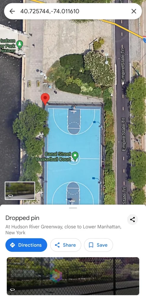
- Use the search bar on the top of the screen to enter the address or location of the land you want to measure.
- Zoom in to get a closer view of the area for clear view.
- Step 3: Enter Measurement Mode
- Tap on the starting point of the land you want to measure until a red pin appears.
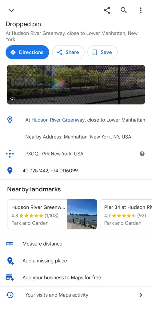
- At the bottom, tap on the name or address of the place, then scroll down and select “Measure distance.“
- Step 4: Add Points
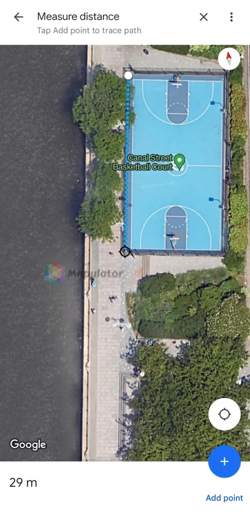
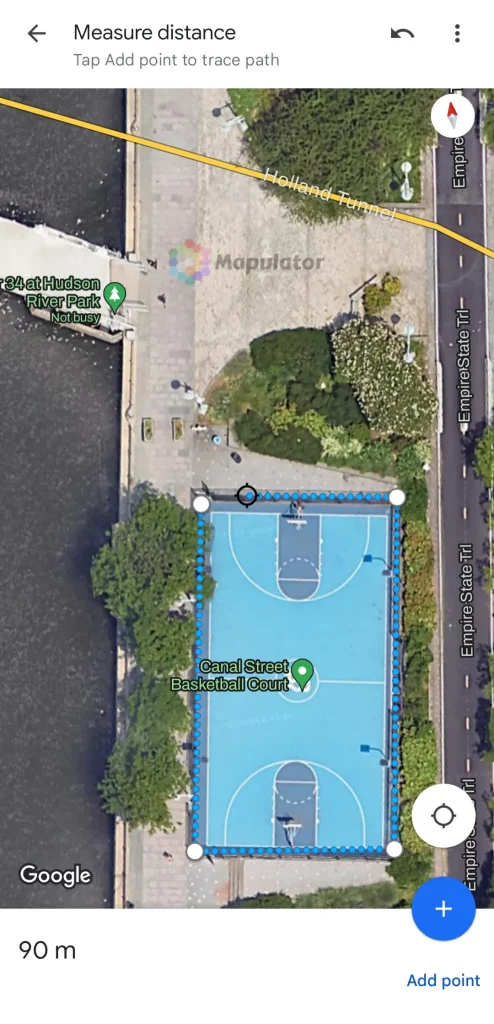
- Move the map to position the next point, and tap “Add point.“
- Repeat this process for each corner of the land until you return to the starting point.
- Step 5: Calculate the Area
- Once you’ve marked all points, Google Maps will display the total distance.
- To calculate the area, you can use a google maps web version. Because on mobile devices google maps app shows only distance measurements.
- You can clear the recent measurement by taping on the three dots on the top right corner of the screen and selecting the clear option.
Note: That on mobile device you can only measure distance on Google Maps. If you want to measure an area then you should use Google Maps Web or the alternate app called Mapulator app which is built on google maps.
For measuring land size with Google Maps, download the app here: Android, iOS, or use it on the Web.
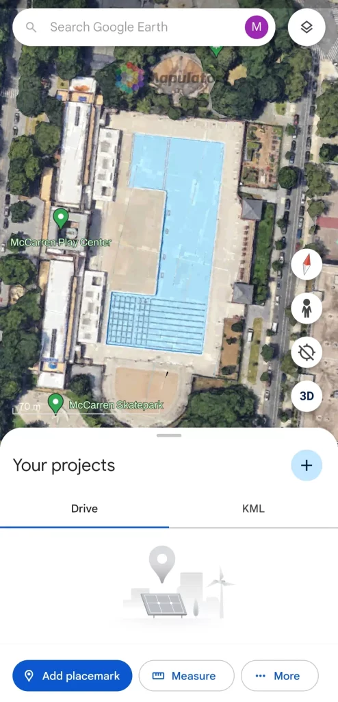
How to Measure using Google Earth
Follow these step-by-step instructions for measuring the land on your mobile device using google earth app.
- Step 1: Open Google Earth App
- Open the Google Earth app on your mobile device. Ensure your GPS location services are enabled.
- Step 2: Find the Location
- Use the search bar to find the land you want to measure.
- Zoom in to get a detailed view of the area.
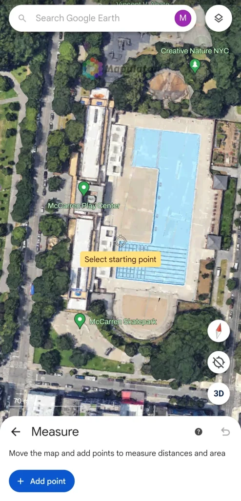
- Step 3: Enter Measurement Mode
- Tap on the “Measure” option at the bottom of the screen.
- If it is not visible, scroll upwards from the bottom of the screen to get the option “Measure.”
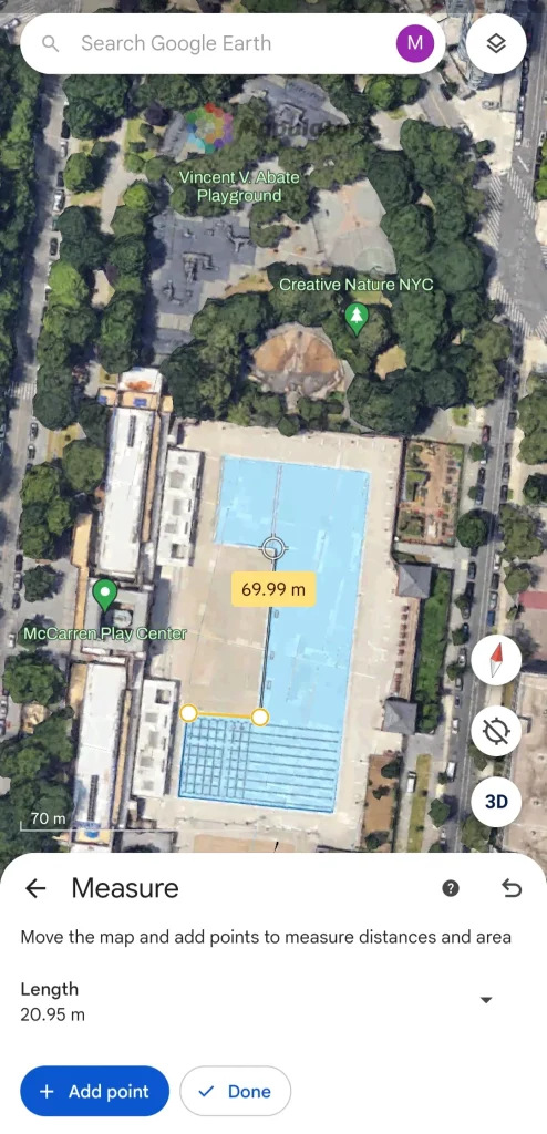
- Step 4: Add Points
- Move the map and place your starting point by tapping on “Add point.” button.
- Continue to tap around the boundary of your land to add points.
- Complete the shape by connecting the last point to the starting point by tapping on the “Close shape” button.
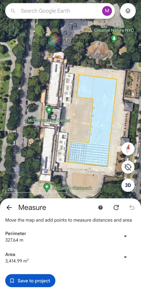
- Step 5: View the Measurement
- Google Earth will automatically calculate and display the perimeter and area of the marked land.
- You can save the measurement for future reference or share it with others.
Note: That on step 4, if you tap on the “Done” button without tapping on the “Close shape” button then you will get only distance. To Close Shape you need to connect the last point to stating point.
(Add Points)
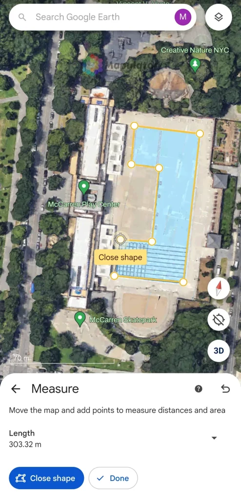
(Close Shape)
For measuring land size with Google Maps, download the app here: Android, iOS, or use it on the Web.
Conclusion
Measuring land with your mobile device is now a straightforward process thanks to tools like Google Maps and Google Earth. By following these simple steps, you can obtain accurate measurements quickly and efficiently. Whether you’re a property owner, a farmer, or a construction professional, these tools can save you time and effort.
However, Google Maps and Google Earth do have their limitations and may lack certain customizations for more specific needs. Curious about other options? Explore alternative tools like the Mapulator app and various third-party applications tailored to fit your needs and budget. Want to discover more about these measurement apps? Check out our other blogs for in-depth reviews and recommendations.