
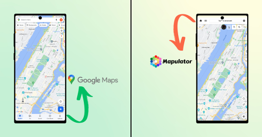
Google Maps has a built-in distance measuring tool. On desktop you need to right-click any starting point, select Measure distance, then click your end point — the distance appears at the bottom of the screen. On the mobile app you need to long-press your starting point, tap the location name pin, then select Measure distance and drag the map to your end point. It's quick for a single one-off check, but it has some real limits once you need to save, share, or do this repeatedly — more on that below.
Measuring distance on Google Maps desktop (step-by-step)
- Open Google Maps in a browser.
- Right-click your starting location on the map.
- Select Measure distance from the menu that appears.
- Click your destination point. A running distance total appears at the bottom of the screen.
- Click additional points to measure a multi-segment path, or drag any point to adjust it.
- Click the "x" or press Escape to clear the measurement when you're done.
Measuring distance on Google Maps mobile (step-by-step)
- Open the Google Maps app and long-press your starting point until a red pin drops.
- Tap the location name or address that appears at the bottom.
- Scroll down and tap Measure distance.
- Drag the map so the crosshair lands on your destination — the distance updates live at the top.
- Tap Add point to measure additional segments along a path.
Where Google Maps' measuring tool falls short
Google Maps is built for navigation and route-finding, not for measurement work — so the tool has some real gaps once you're using it for more than a quick check:
- No saving. Close the tab or the app, and the measurement is gone. There's no way to come back to it later.
- No sharing. You can't send someone your measured line or project — a screenshot is the only workaround.
- Fixed units. Metric or imperial only — no option for custom scales or less common units.
- No GPS tracking. You can't walk or drive a route and have it measure your actual path in real time — it only measures the straight (or manually clicked) line between points you tap. For a single quick check, these limits usually don't matter. For fieldwork, project documentation, or anything you need to revisit or share, they do.
What to use instead: Mapulator
Mapulator is built on top of Google Maps' own satellite imagery, so it's not a replacement for Google Maps — it's a dedicated measurement layer for the cases above. It handles the specific gaps in the native tool:
- Saves projects to your device or cloud, so you can return to a measurement anytime.
- Shares via link or export (KML/GeoJSON), so a colleague can open your exact measurement, not just a screenshot.
- Custom units and multiple layers, so you're not stuck with just metric or imperial.
- Live GPS tracking mode, so you can walk or drive a route and measure the actual path as you move.
- Available on iOS, Android, and in the browser — no install needed for a quick job. It's free to start, with paid plans for heavier use. Worth trying if you find yourself hitting Google Maps' limits more than once.
FAQ about Measuring Distance on Google Maps
Can I measure distance on Google Maps for free?
Yes — the built-in measuring tool is free on both desktop and mobile, no account or app required beyond having Google Maps itself.
Why can't I save my Google Maps measurement?
Google Maps' measuring tool is a temporary overlay, not a saved feature — it's designed for a quick one-time check, not ongoing project data. Closing the map clears it.
Does Google Maps measure distance accurately?
For straight-line or simple multi-point measurements, yes — it uses the same satellite and mapping data as its navigation features. For legally binding or survey-grade work, you'd need a licensed surveyor with dedicated GNSS equipment instead.
What's the difference between Google Maps' measure tool and an app like Mapulator?
Google Maps' tool is built for a quick, temporary check. Mapulator adds saving, sharing, custom units, and GPS-tracked path measurement — useful once you need to keep or reuse the data, not just glance at a number.
Reviewed by the Mapulator team, based on hands-on use across construction, real estate, and field-mapping projects.